
Physical AI-native detection.
One drone-mounted rig fusing cameras, LiDAR and electromagnetic sensing. A model ranks each anomaly and retrains on every item we destroy. Prototype H1 2027.
How it works
A drone carries cameras, LiDAR and an electromagnetic array over the site in one pass.
Onboard AI combines the three sensor streams into one record per anomaly.
Each anomaly gets a decision: dig, leave or confirm, with location, type and depth.
Finds flow into secure destruction on the same custody record.
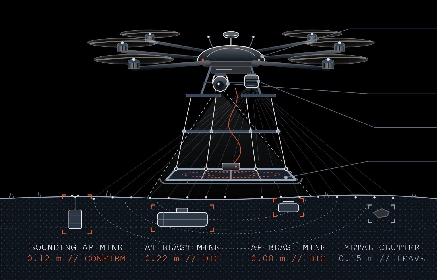
Sensor payload
Colour and thermal, for surface items and disturbed soil.
Maps terrain through vegetation, where cameras see only canopy.
Finds buried metal, including low-metal mines.
One record per anomaly.
In the prototype, sensor streams are fused in flight into one record per anomaly, with location, likely type, depth and a decision. The records go straight to the destruction system.
anomaly     AT blast mine
class       HAZARD
depth_m     0.22
sensors     cam · lidar · em
fused       true
decision    DIG
next        Recover to custody destruction
of excavated items are often non-hazardous when every detected target is dug.
estimated clean-up cost for about 1,700 formerly used US defense sites.
DoD goal for completing munitions response at all remaining sites.
Sources: SERDP-ESTCP, Classification Methods for Military Munitions Response. GAO-22-104744, 2021 DoD estimate. DoD munitions response guidance, Dec 2024.